
Remote sensing with Machine Learning
Machine learning, a subset of artificial intelligence, has been revolutionizing various industries and transforming how we interact with technology. The ability of machines to learn from data and improve their performance without being explicitly programmed is at the core of this field. In this blog post, we will explore the basics of machine learning, its applications, and its potential impact on our lives.
At its essence, machine learning involves the development of algorithms and statistical models that enable computers to learn patterns, make predictions, and take actions based on data. This process typically involves three stages: data collection and preparation, model training, and making predictions or taking actions.
Data plays a vital role in machine learning. The more relevant and high-quality data available, the better the machine learning models can perform. This data can be collected from various sources such as sensors, databases, social media platforms, or even the internet. Once the data is collected, it needs to be preprocessed and cleaned to remove any noise or inconsistencies.
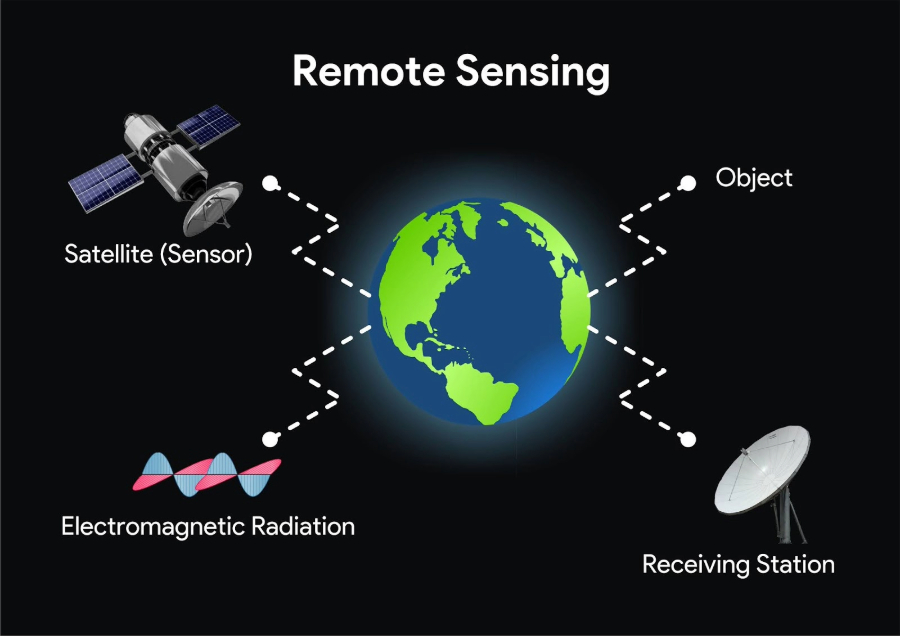
Introduction: Remote sensing has emerged as a powerful tool for capturing vast amounts of data about the Earth’s surface from a distance. From applications in climate monitoring to disaster response, remote sensing technologies continue to revolutionize how we gather information about our planet. However, the sheer volume and complexity of these data sets pose challenges when it comes to analysis and interpretation. This is where machine learning steps in, offering extraordinary potential to augment remote sensing capabilities and unlock new insights. In this blog post, we will explore how machine learning techniques are boosting remote sensing and advancing our understanding of the world around us.
Enhancing Image Classification:
Using machine learning algorithms, remote sensing data can be mined more comprehensively and accurately. With traditional approaches, human analysts manually define image features to identify objects and land cover types. However, this process is time-consuming and prone to human error. Machine learning models, such as convolutional neural networks (CNNs), can effectively learn from large amounts of training data to automatically classify images. By leveraging deep learning networks, we can achieve unparalleled accuracy and efficiency in discerning different land cover categories, such as vegetation, water bodies, and urban areas.
Object Detection and Tracking:
Machine learning algorithms also facilitate object detection and tracking in remote sensing imagery. Whether it’s identifying specific infrastructure, vehicles, or anomalies in a landscape, machine learning models can enhance the extraction of relevant information. By training models on labeled data containing specific objects of interest, we can enable automated detection and tracking at scale. This streamlines tasks such as monitoring land-use changes, identifying illegal activities, or tracking the movement of wildlife.
Improving Spectral Unmixing:
Spectral unmixing is a critical task in remote sensing that aims to decompose mixed signals from various materials within a pixel. Traditionally, this process depended on carefully handcrafted algorithms and expert knowledge. However, machine learning techniques, particularly unsupervised learning methods such as clustering or non-negative matrix factorization (NMF), have shown promising results in automating and improving spectral unmixing. By leveraging the inherent patterns in the data, these models extract valuable information to accurately identify and quantify the individual components within a pixel.
Supporting Hyperspectral Imaging:
Hyperspectral imaging has become increasingly popular in remote sensing applications. It provides a more detailed view of the Earth’s surface by capturing hundreds of narrow and contiguous spectral bands. However, analyzing hyperspectral data is challenging due to the high-dimensional nature of the data and its complex characteristics. Machine learning algorithms can efficiently handle hyperspectral data by employing dimensionality reduction techniques like principal component analysis (PCA) or manifold learning. By reducing the dimensionality, these models extract meaningful features and enable effective classification and analysis of hyperspectral images.
Predictive Modeling and Forecasting:
Combining remote sensing data with machine learning models enables us to develop predictive models and forecasting capabilities. By integrating historical satellite imagery with other environmental and socio-economic parameters, these models can provide insights into land-use change, urban sprawl, deforestation, and other environmental phenomena. Machine learning algorithms enable scientists and policymakers to make data-driven decisions based on accurate predictions and projections, contributing to better management of natural resources and sustainable development.
Conclusion
The combination of remote sensing and machine learning represents a powerful synergy in our quest to understand and manage our planet. As machine learning continues to advance, it brings unprecedented opportunities to process, analyze, and interpret remote sensing data more efficiently and accurately. From enhancing image classification and object detection to spectral unmixing and predictive modeling, the fusion of these two domains opens doors to new possibilities and discoveries, ultimately leading to a deeper understanding of our Earth, more informed decision-making, and better environmental stewardship. Overall, machine learning enables the automation, optimization, and extraction of useful information from remote sensing data, thereby enhancing the effectiveness and efficiency of remote sensing applications.
Source